Revista Produção e Desenvolvimento, v.5, e412, 2019
Doi: https://doi.org/10.32358/rpd.2019.v5.412
Agricultural frontier expansion and their contradictions in central-West brazilian municipalities
|
Francisco de Assis Oliveira Mota Araújo1*; Deusa Maria Rodrigues Boaventura1; Sérgio Duarte de Castro1; Marco Tulio Gomes dos Santos1
1- Pontifícia Universidade Católica de Goiás, Goiânia, 74175-120, Brazil.
|
Submitted: 31/10/2019. Accepted: 30/11/2019
Published: 30/11/2019
ABSTRACT
Purpose: the objective of the article is to analyze the process of agroindustrialization and its contradictions in the Midwest region. Therefore, we considered the processes of industrialization and urbanization that occurred in the municipalities of Dourados/MS, Rondonópolis/MT and Rio Verde/GO important poles of Brazilian agribusiness.
Methodology: the research used a literature review on the subject in online and print scientific journals, books, dissertations and other databases, gathering and comparing the different information found in the sources of consultation and listing the main transformations of socioeconomics from the municipalities studied.
Findings: the investigation demonstrates that the territorial modernization and the spatialization of capital inserted the three municipalities into a higher socioeconomic standard without taking into account urban segregation, social inequality, poverty and the social and environmental problems of the new urban spaces that were opened in these municipalities.
Research Limitation/implication: Among the limitations of the research, it is highlighted that it is possible to extend the analysis to other municipalities in the region. Further comparisons can also be made between industrial dynamics, service sector and labor market activities.
Originality/Value of paper: The process of agroindustrialization and its contradictions in the Midwest region is still a little studied.
KEYWORD: Agricultural frontier; Agroindustrialization; Spatialization of capital; Space Production.
expansão da fronteira agrícola e suas contradições em municípios do centro-oeste braSileiro
RESUMO
Objetivo: o objetivo do artigo é analisar o processo de agroindustrialização e suas contradições na região Centro-Oeste. Portanto, foram considerados os processos de industrialização e urbanização ocorridos nos municípios de Dourados/MS, Rondonópolis/MT e Rio Verde/GO, importantes polos do agronegócio brasileiro.
Metodologia: a pesquisa utilizou uma revisão bibliográfica sobre o assunto em periódicos científicos on-line e impressos, livros, dissertações e outras bases de dados, reunindo e comparando as diferentes informações encontradas nas fontes de consulta e listando as principais transformações socioeconômicas dos municípios estudados.
Constatações: a investigação demonstra que a modernização territorial e a espacialização do capital inseriram os três municípios em um padrão socioeconômico mais alto, sem levar em conta a segregação urbana, a desigualdade social, a pobreza e os problemas socioambientais dos novos espaços urbanos que foram abertos nesses municípios.
Limitação / implicação da pesquisa: Dentre as limitações da pesquisa, destaca-se que é possível estender a análise para outros municípios da região. Também podem ser feitas comparações adicionais entre dinâmica industrial, setor de serviços e atividades do mercado de trabalho.
Originalidade: O processo de agroindustrialização e suas contradições na região Centro-Oeste ainda é pouco estudado.
PALAVRAS CHAVE: Fronteira agrícola; Agroindustrialização; Espacialização do capital; Produção do Espaço.
1. INTRODUCTION
The industrialization process, despite benefiting Brazilian central-west cities, comes with problematic dilemmas. It is important to analyze the country's industrialization process, to elucidate the influence which these processes have and still have on the production and reproduction of urban spaces. Regarding this issue, it is possible to state that this growth is directly associated with the agricultural frontier expansion since the decade of 1970, based on extensive livestock and on soy monoculture. The territorial modernization and the capital specialization managed to insert cities in an improved socioeconomic pattern, without regarding the urban segregation, the social inequality, the poverty and the social and environmental problems of these new urban zones opened through these municipalities.
The Brazilian central-west has been a subject of analysis of various researchers recently (Oliveira Neto et al., 2015; Assis et al., 2018; Nogueira et al., 2018; Fernandes et al., 2019; Gonzaga et al., 2019; Garcia et al., 2018). However, none of them discuss in specifics the cities of Dourados, in Mato Grosso do Sul; Rondonópolis, in Mato Grosso; Rio Verde, in Goiás, inserted in the national urban network as important agribusiness hubs of the central-west region, as a result of agro industrialization. The agricultural production transformations are related to agro-industry modernization (agricultural product industrialization), farming (agricultural and zoo-technical practices) and agribusiness (supply chain operations and commercialization), which generate countless interrelationships between grain production and animal protein, industry, and services.
These activities submit themselves to the capital insertion planning in the countryside, via agribusiness operations, which design the restructuring of production in the shape of workforce flexibilization, the opening of new markets, new productive layouts, and new organizational forms, besides the production and the space consumption in these cities. Moreover, the capital and production spatialization are reflected in the production form and in the movement of goods, in the provision of services, in the new technologies, in the new productive resources, in the new social relations and, therefore, in the new spaces. (BARROS, 2019, translated). This article's objective, therefore, is to analyze how economic growth and the spatial redistribution of the population determined the production and reproduction of these spaces in these three municipalities. This region's dynamic still is little studied, thus, this article contributes to the studies of productive transformations processes and territorials of the center-west.
The work is divided into three parts. The first describes the methodology used in research. The second is a literature summary that addresses agro industrialization, capital spatialization, and population spatial redistribution in the cities of Dourados/MS, Rondonópolis/MT e Rio Verde/GO. Finally, considerations are presented about the impacts of production and space consumption from industrialization, urbanization and the contradictions of these advances.
2. MATERIALS AND METHODS
A bibliographic review was made about the subject in on-line and printed scientific academic journals, compiling and comparing different data found in the sources also listing the most important socioeconomy transformations in the cities of Dourados/MS, Rondonópolis/MT e Rio Verde/GO.
Was opted for exploratory research, which, according to Severino (2016), only seeks to gather information about a certain object, thus delimiting one field of work, mapping the conditions of this object manifestation. In truth, this manifestation is preparation to explicative research. Was considered the research REGIC (2007) and data from “Instituto Brasileiro de Geografia e Estatística” (IBGE), “Instituto de Pesquisa Econômica Aplicada” (Ipea) in addition of other state public agencies.
3. AGROINDUSTRIALIZATION, SPATIALIZATION OF CAPITAL AND SPATIAL REDISTRIBUTION OF POPULATION
In the 1970s, the central-west region economy participation did not attain 4.0% in the Gross Domestic Product, however, nowadays it contribution to the GDP is close to 10%. This contribution to national production is related to agro-industrial complex strengthening in the three states that compose the region, characterized by verticalized, modern and large companies.
The agroindustrial companies installation in the center-west is not a recent process, especially in the case of products superficial processing operations as rice, animal butchery, wood, cornmeal, etc. Which is relatively new in the region is the large agroindustrial companies presence which extends their operations to the commodities, on one side, and in the internal market, at the other, integrating at a regional level two productive chains, grains and meat, with extremely dynamic results in the region. (CASTRO; FONSECA, 1995).
These particular companies benefited by the region's climate and soil, which are quite appropriate to more aggressive cultivation and farming production. The center-west predominant biological unity is the “Cerrado”, covering 204 million hectares, or 23% of the Brazilian territory extension. It is the second biggest Brazilian biome, only smaller than the Amazon biome, extending by 350 million hectares.
In addition to the locational and environmental advantages, other structuring categories guaranteed the region agroindustrial success, such as the adoption of audacious agricultural policies (rural credit expansion, agricultural income guarantee mechanisms and rural services expansion); agricultural technology massive investment (created directly or indirectly by Embrapa); and, adapted development of productive systems to the more specific region conditions, helping production logic and capitalist reproduction.
In relation to urban expansion, in the '70s, the central-west presented a population growth rate of 4.9% per year, being the second biggest in Brazil between 1970-2010, only behind the North region. Table 1 shows population growth in Mato Grosso do Sul, Mato Grosso, and Goiás in the 1970-2010 period, fed by high migration rates, associated with vegetative growth.
Table 1 – Total population, average growth rate and degree of urbanization
Central-West Region – 1970-2010
|
States |
Mato Grosso do Sul |
Mato Grosso |
Goiás |
|
|
Total Population |
1970 |
998.211 |
598.879 |
2.414.325 |
|
1980 |
1.393.019 |
1.134.230 |
3.125.354 |
|
|
1991 |
1.778.741 |
2.022.524 |
4.012.56 |
|
|
2000 |
2.075.275 |
2.498.150 |
4.994.897 |
|
|
2010 |
2.449.024 |
3.035.122 |
6.003.788 |
|
|
Growth Rate (% per year) |
1970/80 |
3,39 |
6,59 |
2,61 |
|
1980/91 |
2,25 |
5,4 |
2,3 |
|
|
1991/00 |
1,73 |
2,37 |
2,46 |
|
|
2000/10 |
1,66 |
1,94 |
1,84 |
|
|
Degree of Urbanization(%) |
1970 |
45,3 |
38,8 |
45,9 |
|
1980 |
66,8 |
57,7 |
67,5 |
|
|
1991 |
79,4 |
73,3 |
80,8 |
|
|
2000 |
84 |
79,4 |
87,9 |
|
|
2010 |
85,6 |
81,8 |
90,3 |
|
Source: IBGE (1970, 1980, 1991, 2000, 2010).
The countryside medium urban centers' development of these states occurred in a bigger proportion than the average registered in the country, excluding the North region.
An important aspect, however, the north and central-west region start from a smaller base than the rest, since their territories are more vacant, with lesser urban networks. The region has a new economic and demographic reality, this is reflected in economic advantages, redefining the functions executed by the more dynamic cities, promoting bigger integration between them and intense flux of people, goods and services. According to Sassen (1993, p. 32, translated), "[...] the combination of geographic dispersion and integration [...] created a new strategic role for the [...] cities", which now began to concentrate command functions and house companies and governments in spaces that "[...] utilize of products and services of the financial market and contract specialized services" (SASSEN, 1998, p. 8, translated).
Accordingly, a new socioeconomic articulations network needs a new model of spatialization and regionalization of cities in a fragmentation process and an industrial polarization concentration reversal, verified in the Southeast region. Therefore, this productive expansion takes the form of agricultural frontier expansion in the Center-west, benefiting from the excessive labor offer, the new consumer markets that absorb the goods produced, the productive resources offer and telecommunications infrastructure, transportation, highways, and ports. Thereby, a new productive information system linked to the capital, which is not limited to traditional metropolis spaces, which, contrary to medium-sized cities, present accumulation diseconomies. Thus, the capital restructure demands a new territorial hierarchy from these new urban connections (production and space consumption).
On the verge of these transformations, thrived and were consolidated the economies of Dourados/MS, Rondonópolis/MT e Rio Verde/GO, that opened commercially to internal and external markets, with the product offering of grains, meat, dairy products, tomato products, sugar, and alcohol. Hence, the urbanization intensification and function ampliation of these cities were determined, vastly, by the agricultural frontier expansion and the central-west industrial production, responsible by a new territorial configuration (transportation networks, communication, production, and energy distribution). This territorial modernization causes these more fluid spaces, allowing bigger goods mobility and services, of production factors, of labor and of capital, internalizing populations and the economy itself.
This scenario, according to Harvey (1992), characterizes itself by the emergence of entirely new production sectors, providing new financial services approaches, new markets, and, especially, greatly intensified rates of commercial innovation, technological and organizational. The agricultural frontier expansion case in the municipalities evaluated, the transition of a rural complex to agroindustrial occurred under the auspices of agribusiness, from the defined dynamic defined by an industrial accumulation pattern which represents the productive restructure in an effective moment, transforming the forms and the production content and space reproduction.
CANDIOTTO and CORRÊA (2008) asserted that soil characteristics, and, the approach which is used or allocated in production\reproduction system, together with other natural elements ultimately determine a distinction between the concepts of rural space and urban space. The rural space corresponds to one specific medium, with more natural characteristics than the urban space, which is produced by use multiplicity that the soil or the 'natural space' appears as a primordial factor, what has resulted in multiple times creation and remaking in social forms of strong local inscription, that is, intense territoriality.
The dynamic in the rural space was integrated into the urban space by territory articulation and economic interest networks kept invulnerable some social, territorial and, political structures, which are incompatible with the dynamics of socio-economic development encompassing social and territorial equity (regional balance).
4. POPULATION AND ECONOMIC GROWTH AT THE CITIES
With the deepening of discussions on regional development and regional imbalances combat, the subject in medium-sized cities gained importance in the academic and political-institutional world, remarkably so influenced the urban public politics in Brazil in the '70s and '80s. The concern was with maintaining economic growth with the industrialization, in this aspect, the II PND concentrates efforts for the implementation of transport infrastructure (roads and waterways) and the communication that benefits this kind of city.
The conceptualization early attempts of medium-sized cities considered the size of the population, the socio-economic importance, spatial relations, and the function occupied in the national and regional urban hierarchy (SPOSITO, 2004). As previously mentioned, for the elaboration of this study, the municipalities of Dourados/ MS (220,965 inhabitants), Rondonópolis/MT (228,857 inhabitants) and Rio Verde/GO (229,651 inhabitants) were chosen, thus considering the size of their populations, are in the amplitude of 50,000 to 300,000 inhabitants, according to IBGE estimates for 2018.
4.1 Dourados/MS municipality
According to the 2010 Census, Dourados/MS (figure 1) has 196,068 inhabitants, thus being the second municipality in population terms of the state of Mato Grosso do Sul.
Figure 1 – Dourados/MS municipality localization
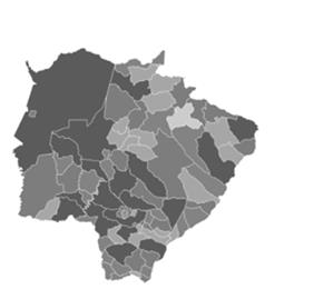
Source: IBGE (2010).
The city's headquarters is 225 kilometers from the capital, Campo Grande (Figure 1), and, occupies 4,086.20 square kilometers, which corresponds to 1.20% of the state.
In 2014, the populational density calculated in Dourados was 51.45 inhabitants per square kilometer. According to estimates of the population residing in Brazilian municipalities on July 1, 2018, it had an increase of 24,930 inhabitants in relation to 2010, was shown in Table 2.:
Table 2- Important medium-sized cities of Mato Grosso do Sul population evolution– 1970 to 2018
|
Municipality |
1970 |
1980 |
1991 |
2000 |
2010 |
2018 |
|
Corumbá |
54.015 |
81.145 |
88.411 |
95.701 |
103.703 |
110.806 |
|
Dourados |
79.958 |
100.987 |
135.984 |
164.949 |
196.035 |
220.965 |
|
Naviraí |
23.178 |
28.564 |
30.670 |
36.662 |
46.424 |
54.051 |
|
Nova Andradina |
12.766 |
21.668 |
29.848 |
35.381 |
45.585 |
53.517 |
|
Ponta Porã |
34.482 |
38.070 |
50.950 |
60.916 |
77.872 |
91.082 |
|
Sidrolândia |
9.758 |
12.847 |
15.545 |
23.483 |
42.132 |
56.081 |
|
Três Lagoas |
56.231 |
52.950 |
68.162 |
79.059 |
101.791 |
119.465 |
Source: IBGE.
The economic importance of Dourados began being recognized in the 1940s, with the monopoly of “Companhia Mate Laranjeira” in the exploitation of yerba mate, common plantation in all south region of, back then, state of Mato Grosso. With federal government intervention, through the Marcha para o Oeste program, was created in 1943 the “Colônia Agrícola Nacional de Dourados” (CAND), which lead to a significant migratory flow and fomented a regional economic dynamic. This governmental action began an enabling environment for other investment efforts, by the state government, and by the private initiative.
According to Silva (2000, p. 101-102), the federal and state government participation stimulated the interest of private capital, in the form of new colonization projects and agricultural production. The new Dourados capitalists had at their disposal abundant financial resources from the “Sistema Nacional de Crédito Rural” (SNCR), that had the finality of incentivizing the farming practices modernization of this region, by implanting a productive structure based on rural extension research development, road infrastructure, electric and storing network, this happened at the end of the 1960s and in the start of the 1970s.
Table 3 shows that Dourados consolidated the position of regional development hub, attracting investments in bigger volumes and agroindustrial complex oriented, thus, generating new economic and socio-spatial interactions. This capital spatialization occurred in the function of agricultural expansion in all center-west, provoking a new economic dynamism in Dourados.
Table 3 – Population by domicile (1970-2010)
|
Year |
Urban population |
Rural population |
Total |
||
|
Inhabitant number |
% over total |
Inhabitant number |
% over total |
||
|
1970 |
106.630 |
27,92 |
275.329 |
72,08 |
381.959 |
|
1980 |
294.494 |
57,22 |
220.190 |
42,78 |
514.684 |
|
1991 |
439.577 |
70,92 |
180.244 |
29,08 |
619.821 |
|
2000 |
331.725 |
81,40 |
75.787 |
18,60 |
407.512 |
|
2010 |
409.456 |
81,74 |
91.463 |
18,26 |
500.919 |
Source: IBGE – Censos 1970, 1980, 1991, 2000, 2010.
An analysis of Table 3 allows noticing at the '70s the population of Dourados that lived in the rural zone as the majority, corresponding for 72.08% of the city inhabitants. In the 1980s, it is noticeable the falling population movement, when the number of area inhabitants shrinks to 57.22%. In 2010, the rural population had dropped off to 18.26% of the total inhabitant number, when the urban population had a mark of 81.74%.
This movement can be justified by the soy culture expansion in the region and by the adopted public politics, which helped to consolidate the early agroindustry in Dourados and other neighboring municipalities. The data shows that population growth verified in Dourados is related to the new function that the city came to play, by integrating to the agro-industrial complex and specialize in grain production and the livestock industry, attracting manpower.
The following Table 4 shows the rapid economic growth, based on the exploitation of large crops (soybean, corn and wheat) and livestock.
Table 4 – Gross Domestic Product
|
Brazil, Federation Unit and Municipality |
Year |
|||
|
1999 |
2000 |
2010 |
2012 |
|
|
Brazil |
1.064.999.712.000 |
1.179.482.000.000 |
3.770.084.872.000 |
4.392.093.000 |
|
Mato Grosso do Sul |
10.172.208.000 |
43.514.207.000 |
43.514.207.000 |
54.471.447.000 |
|
Dourados/MS |
976.243.000 |
3.543.860.000 |
3.543.860.000 |
3.543.860.000 |
Source: IBGE – Sistema IBGE de Recuperação Automática - SIDRA
Soy is the main grain cultivated in the cities of Maracaju, Caarapó, Rio Brilhante, Fátima do Sul e Itaporã, localized in the same region of Dourados, this allows the city to act as a regional capital and, consequently, as one of the largest agribusiness centers in Brazil.
The contemporary economic framework of Dourados characterizes itself by the agribusiness and agroindustry complexes, however, it is not restricted to that, because for Dourados it contributes as well large factories in cement and fiber cement branches, metallurgy and home appliance production.
4.2 Rondonópolis/MT municipality
In 2010, the Rodononópolis/MT population was 195,476 inhabitants according to IBGE's Censo of that year. The next populational estimate in 2018 was 228,857 inhabitants, its area is 4,181.58 square kilometers and its density is 46.76 habitants per square kilometers. The localization in the state of Mato Grosso is shown in figure 2.
Figure 2 – Rondonópolis/MT localization
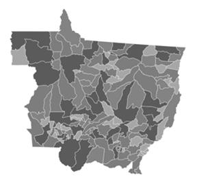
Source: IBGE (2010).
Table 5 provides data on population growth in the state of Mato Grosso from 1970 to 2018, revealing a significant expansion in the number of inhabitants in the municipality of Rondonópolis.
Table 5 – Population evolution [...] Mato Grosso – 1970 to 2018
|
Municipality |
1970 |
1980 |
1991 |
2000 |
2010 |
2018 |
|
Alta Floresta |
- |
23.011 |
53.031 |
46.956 |
49.164 |
51.615 |
|
Barra do Garças |
28.403 |
33.906 |
45.712 |
52.092 |
56.560 |
60.661 |
|
Cárceres |
86.552 |
52.644 |
68.624 |
81.316 |
87.942 |
93.882 |
|
Lucas do Rio Verde |
- |
- |
6.693 |
19.316 |
45.556 |
63.411 |
|
Primavera do Leste |
- |
6.874 |
12.523 |
39.857 |
52.066 |
61.038 |
|
Rondonópolis |
63.098 |
81.366 |
123.171 |
150.227 |
195.476 |
228.857 |
|
Sinop |
- |
12.232 |
36.883 |
75.002 |
113.099 |
139.935 |
|
Sorriso |
- |
1.605 |
15.114 |
35.605 |
66.521 |
87.815 |
|
Tangará da Serra |
- |
31.303 |
39.846 |
58.830 |
83.431 |
101.764 |
|
Várzea Grande |
10.095 |
76.678 |
162.181 |
215.446 |
252.596 |
282.009 |
Source: IBGE
The investments to rural modernization in Mato Grosso state and, consequently, in Rondonópolis, drove urban sprawl, producing a specialized space in the activities in soy and cotton refine, as well as in the industrialization livestock products. Rondonópolis' population movement (Table 6) is related to territorial modernization in economic transformations terms arising from reproduction and accumulation of capital linked to the agro-industrial sector, which eventually redefined its role as the middle-sized city.
The table 6 shows how the increased agricultural production implied in the decrease in the number of residents in rural areas of the municipality and the increase in residents in urban areas, movement justified by the increase of workers revenue and the search for more quality of life, another factor which produced this effect was the mechanization of agricultural production.
Table 6 – Population by domicile in Rondonópolis (1970-2010)
|
Year |
Urban population |
Rural population |
|
Total |
|
|
Inhabitant number |
% over total |
Inhabitant number |
% over total |
||
|
1970 |
25.126 |
40,47 |
36.960 |
59,53 |
62.086 |
|
1980 |
64.983 |
79,86 |
16.392 |
20,14 |
81.375 |
|
1991 |
113.032 |
89,30 |
13.595 |
10,70 |
126.627 |
|
2000 |
141.838 |
94,40 |
8.389 |
5,60 |
150,227 |
|
2010 |
188.028 |
96,20 |
7.448 |
3,80 |
195.476 |
Source: IBGE – Censos 1970, 1980, 1991, 2000 e 2010.
The movement shown in Table 6 is linked to the central role that Rondonópolis took with the strengthening of commercialization and goods and services distribution, making relations more complex with other cities, for being a regional hub. The relation with Brazilian Gross Domestic Product (GDP), the state of Mato Grosso and the municipality of Rondonópolis in the period 1999-2012 can be verified in Table 7.
Table 7 – Gross Domestic Product (Thousand reais)
|
Brazil, Federation Unit and Municipality |
Year |
||||
|
1991 |
2000 |
2010 |
2010 |
2016 |
|
|
Brazil |
1.064.999.712 |
1.179.482.000 |
3.770.084.872 |
4.392.093.997 |
6.267.205.000 |
|
Mato Grosso |
12.364.905 |
14.870.533 |
59.599.990 |
80.830.108 |
123.834.253 |
|
Rondonópolis/MT |
776.280 |
922.586 |
5.094.939 |
5.888.661 |
9.418.111 |
Source: IBGE – Sistema IBGE de Recuperação Automática - SIDRA
Rondonóplis GDP growth in the 1999-2012 period was characterized by the strong mechanization process of the rural environment and the agro-industrial drive, which allowed the city to be a sub-regional center, according to REGIC 2007 classification. The importance assumed by Rondonópolis represented new functions opportunities arising from the production restructuring of the agro-industrial complex, extrapolating the local market and giving the status of the city of agribusiness.
4.3 Rio Verde/GO municipality
Like the other cities previously presented, Rio Verde (figure 3) had a big impact on countryside modernization, with the function altered inside the state urban network in Goiás and in the Central-West region
Figure 3 – Rio Verde/GO location
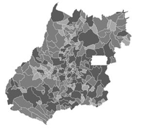
Source: IBGE (2010).
Table 8 shows, according to the 2010s Censo, the population of Rio Verde at that year was 176,424 Inhabitants, and, since the 1970's the growth of the number of Inhabitants and transformed its landscape, from almost predominately rural to a more urbanized standard.
Table 8 – Population evolution of Goiás – 1970 to 2018
|
Municipality |
1970 |
1980 |
1991 |
2000 |
2010 |
2018 |
|
Catalão |
27.809 |
40.238 |
54.922 |
64.490 |
86.647 |
106.618 |
|
Itumbiara |
64.666 |
79.448 |
74.698 |
81.430 |
92.883 |
103.65 |
|
Jataí |
42.772 |
55.420 |
62.640 |
75.451 |
88.006 |
99.674 |
|
Mineiros |
15.790 |
23.309 |
31.144 |
39.024 |
52.935 |
65.420 |
|
Rio Verde |
56.740 |
76.681 |
89.756 |
116.552 |
176.424 |
229.651 |
Source: IBGE
This field to the city migration can be proven through Table 9 data, which is noticeable in the period 1970 – 2010, the urban population growth was accentuated, according to IBGE census data (Censo 1970 and 2010).
Table 9 – Population by domicile in Rio Verde-GO (1970-2010)
|
Year |
|
|
|
|
Total |
|
Inhabitant number |
% over total |
Inhabitant number |
% over total |
||
|
1970 |
26.927 |
48,35 |
28.770 |
51,65 |
55.697 |
|
1980 |
55.541 |
74,35 |
19.158 |
25,65 |
74.699 |
|
1991 |
84.142 |
87,37 |
12.167 |
12,63 |
96.309 |
|
2000 |
106.079 |
91,01 |
10.473 |
8.99 |
116.55 |
|
2010 |
163.540 |
92,70 |
12.884 |
7,30 |
176.44 |
Source: IBGE – Censos 1970, 1980, 1991, 2000 e 2010.
The Rio Verde socio-economic base has also been redefined by the refunctionalisation, the city has changed from the new productive relations that have been established in its territory. The municipality has an area of 8,415.98 km², according to data from Atlas Brasil (2016), with a density of 20.97 inhabitants per squared kilometers. A fact that calls attention is that Rio Verde, together with Jataí, surpassed other Goiás municipalities, since its economy stood prominently and acquired greater centrality than the others.
This centralization results from trade development and services sector diversification of Rio Verde, including financial specialization from medical services providers, teaching institutes, among others. The evolution of these activities are associated with the demands that emerged with the expansion of the process of industrialization of agricultural production in the municipality.
Table 10 displays the evolution of Rio Verde's GDP, that grew systematically following the implantation of the agro-industrial complex in the city, growth that reached more than 100% in 10 years. In 2010, the GDP, which in 2000 was R$ 987.518 millions, reached R$ 4.1605 billion, elevating Rio Verde to the fourth wealthiest city in the state of Goiás.
Table 10 – Gross Domestic Product (Thousand reais)
|
Brazil, Federation Unit and Municipality |
Year |
|||
|
1999 |
2000 |
2010 |
2012 |
|
|
Brazil |
1.064.999.712 |
1.179.482.000 |
3.770.084.872 |
4.392.093.997 |
|
Goiás |
22.191.346 |
26.249.031 |
97.575.930 |
123.926.301 |
|
Rio Verde/GO |
847.794 |
987.519 |
4.160.896 |
6.264.991 |
Source: IBGE – Sistema IBGE de Recuperação Automática - SIDRA
The data shows, however, that the economic development processes, urbanization, productive restructuration, and, agricultural area re-functionalization, elevated this city to a regional agribusiness and agro-industry hub.
4.4 Production and consumption of space: industrialization and urbanization
The central-west region presents currently an intense sociospatial dynamic, as a consequence of productive and economic transformations that modernized its territories. These transformations modified the structures and urban patterns of Dourados/MS, Rondonópolis/MT e Rio Verde/GO in the decades 1970 – 1980, through the development of agro-industrialization, as already mentioned.
Economic expansion, in addition to depleting rural areas and swelling urban areas, demanded qualitative and quantitative changes on the three cities, in other words, new neighborhoods, new residences, new streets, and new technical networks and other equipment have emerged. Therefore, production and space consumption in each one has reverberated the movement of society, because as Lombardo states (1985), the city is the biggest social expression produced and its reality more complex and transformed.
Therefore, to comprehend the real movement of a city is necessary to learn the social and productive relations that products and consumes its spaces, industrialization and urbanization as historical processes which products and consume spaces of a city. The reproduction of these processes is commanded by agents like the State, the capital and, certain social groups.
According to Lefebvre (1999, p. 9), industrialization and urbanization are both inseparable and conflicting phenomena, and this can be seen in the reality of these municipalities, as noted in agro-industrial complex installation on Dourados/MS, Rondonópolis/MT e Rio Verde/GO emerged as a solution for the lack of employment, income growth and economic development.
In the analyzed cities, there was the exclusion and social inequality reproduction, to an extent that urban landscapes of all reflected social and residential segregation, the "favelização" of the periphery and socio-environmentalism problems which arise from the lack of a basic sanitation structure, the housing deficit and the expansion of slum areas.
According to Elias and Pequeno (2017), in the most recently established agribusiness cities, their function change, the "favelização" process is more pronounced, and, the actual conditions for housing construction collaborate so that these spaces reflect even more the situation of poverty. inequality and exclusion, as characteristic impacts of the new production relations, brought by the intensification of capitalism in the countryside.
These kinds of problems caused the convergence between the interests and the concerns of several types of companies regarding the infrastructure made available by the municipal governments of Rondonópolis/MT, Dourados/MS and Rio Verde/GO. These companies claim, still today, of inadequate sanitation, of telephony and internet network problems, of asphalt bad quality and electric network deficiency in the municipalities industrial districts. (SANTOS, 2017).
The restructuring of space, however, follows a pattern of dispersed and fragmented urbanization, that makes urban empty spaces and discontinuity of urban-fabric. As argues Calixto (2017), the differentiated production of space expresses the different forms of appropriation, which, in turn, end up removing a significant portion of the population from the possibility of use, to the extent that not only mediate but deny this need (of use), reducing the right to inhabit the imposition of private property of land.
In this perspective, it is possible to comprehend the "valorization" and distinguished use in some areas of Dourados, represented by the South portion (with the occupation of social demand with smaller income) and the North (higher income social segment). These practices denote the fragmentation in the city territory, with areas with differentiated functionalities.
5. BRAZILIAN CENTRAL-WEST: GROWTH AND TRANSFORMATION
The Brazilian central-west is undergoing an important process of growth and transformation since the 1970s. Brasilia's construction and infrastructure investments that accompanied it, within the scope of the Plano de Metas and the II PND, logistic conditions were created for the agricultural and mineral frontier expansion. Flat land, favorable to mechanization, and, soil correction technologies developed by Embrapa turned the “Cerrado” areas, especially those close to new infrastructure, privileged spaces to the expansion of modern grain production in the molds of "Green Revolution". At the same time, the more favorable conditions of outflow attracted important investments aimed at exploring the mineral potential of the region.
This transformation movement can be divided into two big moments. The first, which runs roughly from 1970s to 1990s, described by intense expansion and modernization of agriculture and livestock and growth of mineral exploration. The second, from the 1990s to the present day, described by strong agro-industrialization.
Between the spatial and social repercussions of this process, two stand out, extremely correlated: the transformations on the urban network configuration and the regions principal social indexes, specially, referring to income distribution.
From a social standpoint, the first moment is characterized by the movement of personal income concentration, accompanying a significant concentration of the land and industrial product. Referring to the urban network, there is an advance in urbanization with a strong trajectory of metropolization. This trajectory results, on one side, big metropolitan region formation with slums and serious infrastructure problems, on the other side, various small towns that are socially stratified at extreme points of income. Thus, configuring a bipolar urban network, with a limited presence of medium-sized cities.
The second moment, the agro-industrialization advance, is accompanied by an income concentration trajectory and by metropolization slowdown, with the enlargement from medium-sized cities. This moment involves a polarized internalization of industry, which stimulates the growth and services diversification in emerging hubs linked to agribusiness, which, in turn, produces social differentiation with the emergence of some medium-sized segments, but also reproduces serious urban socio-environmental problems.
6. CONCLUSION
The expansion of agribusiness, the modernization of agriculture and farming and the implementation of agro-industrial complexes found favorable environmental conditions in the central-west region, in addition to incentives and investments in science and technology made by the agents involved: the state, capital, and social groups. The spatialization of capital promoted the productive restructuring and territorial integration of the states of Mato Grosso do Sul, Mato Grosso, and Goiás, which also enabled economic growth and the redistribution of their populations (reduction in the number of residents of rural areas in municipalities and increase in residents in urban areas). These phenomena modified the labour relations, the rural-urban relationship and the urbanization process of the cities of Dourados/MS, Rondonópolis/MT and Rio Verde/GO.
It is clear that was the agricultural frontier expansion of these cities favoured the implantation of technical networks (transportation, energy, and communication), urban appliances and other state agencies offering public services. With this, occurred the production process and space consumption in these municipalities, having as a historical determinant the urban-industrial transformations caused by the reordering of the capitalist economy and a requirement of contemporary society. In this new panorama, marked economic development and the improvement of socio-economic indexes of Dourados/MS, Rondonópolis/MT e Rio Verde/GO, signified the redefinition of new spatialities and the specialization of productive activities, which, in turn, result in new spatial logics.
If by one side there was a certain qualification of the urban-fabric, with construction and launch of high-standard closed residential housing and luxurious business properties, on the other side, the pattern of urbanization was dispersed and fragmented. This pattern resulted in urban vacuums, discontinuity of the main urban body and impoverishment of public space in the cities analysed, with social and residential segregation, the "favelização" of the slum and the creation of socio-environment problems caused by a fault of basic sanitation structure.
The residential segregation in Dourados/MS, Rondonópolis/MT e Rio Verde/GO has some origins in common: a considerable number of idle land for speculative proposes only; the implantation of housing estates separated from the urban-fabric; the increased social inequality and concentration of income in the hands of few; control and production of urban space by the local elite; lack of urban planning for balanced and orderly development; property speculation; the conniving role of the State with high-income social groups; and the increase in population from the 1980s onwards. All these items are directly or indirectly related to the process of "agricultural modernisation" of “Cerrado” of Central-west region and its vertical implantation of production by the agro-industries, turning the urban space a reflection of the transformations taking place in the countryside.
In regard to the principal consequences observed, can be noted: the fragmentation of urban space produced, which becomes an unequal place of social groups distribution; the privatization of public space; the reproduction of social inequality; space reduction of social groups interaction; the deterioration of the sense of community and neighbourhood; the increasing educational, cultural and economic gaps between social classes; the unequal distribution of urban infrastructure between neighbourhoods; and the increase of environmental problems, unemployment, diseases and violence.
REFERENCES
ASSIS, T. F.; GONÇALVES, D. N. S.; SILVA, M. A. V. Assessing the agricultural commodities transportation in the state of mato grosso: scenarios destined to exportation. Revista Produção e Desenvolvimento, v. 4, n. 2, p. 31-41, 2018.
BARROS, E. A. R. O trabalho temporário no serviço público. Revista de Gestão e Projetos, v.2, n.2, p.150-165, 2019.
CALIXTO, M. J. M. S. As articulações político-ideológicas do poder público no processo de (re) definição da diferenciação sócioespacial. Boletim Paulista de Geografia, n. 78, p. 77-96, 2017.
CANDIOTTO, L. Z. P.; CORRÊA, W. K. Ruralidades, urbanidades e a tecnicização do rural no contexto do debate cidade-campo. CAMPO-TERRITÓRIO: Revista de geografia agrária, v. 3, n. 5, 2008.
CASTRO, A.C.; FONSECA, M.G.D. Dinâmica agroindustrial do centro-oeste. 1995.
ELIAS, D.; PEQUENO, R. Desigualdades socioespaciais nas cidades do agronegócio. Revista Brasileira de Estudos Urbanos e Regionais, v. 9, n. 1, p. 25-39, 2007.
FERNANDES, V. A., PACHECO, R. R., FERNANDES, E., SILVA, W. R. Regional change in the hierarchy of Brazilian airports 2007–2016. Journal of Transport Geography, v. 79, p. 102467, 2019.
GARCIA, M. S.; VILPOUX, O.F.; CEREDA, M. P. Distributed electricity generation from sugarcane for agricultural irrigation: A case study from the midwest region of Brazil. Utilities Policy, v. 50, p. 207-210, 2018.
GONZAGA, J. F.; VILPOUX, O. F.; PEREIRA, M. W. G. Factors influencing technological practices in the Brazilian agrarian reform. Land Use Policy, v. 80, p. 150-162, 2019.
HARVEY, D. Condição pós-moderna. São Paulo: Loyola, 1992.
IBGE, Instituto Brasileiro de Geografia e Estatística. Censo demográfico. Sinopse Preliminar. 1970, 1980, 1991, 2000, 2010. Disponível em <https://biblioteca.ibge.gov.br/biblioteca-catalogo.html?id=769&view=detalhes>). Acesso em: 19/01/2019.
IBGE, Instituto Brasileiro de Geografia e Estatística. Estimativas de população residente nos Municípios Brasileiros com data de referência em 1º de julho de 2018. Rio de Janeiro, 2018.
IBGE, Instituto Brasileiro de Geografia e Estatística. Regiões de influência das cidades – 2007. Rio de Janeiro: IBGE, 2008.
LEFEBVRE, H. A revolução urbana. Tradução de Sérgio Martins. Belo Horizonte: Ed. UFMG, 1992.
LOMBARDO, M. A. Ilha de calor nas metrópoles: o exemplo de São Paulo. Editora Hucitec com apoio de Lalekla SA Comércio e Indústria, 1985.
NOGUEIRA, M. A. F. S.; VILPOUX, O. F.; BINOTTO, E. Brazilian settlers from agrarian reform in the Midwest region of Brazil: Factors involved in collective action through cooperatives and associations. Journal of Cooperative Organization and Management, v. 6, n. 2, p. 111-123, 2018.
OLIVEIRA NETO, M. SANTOS DE; REIS, A. C.; STENDER, G. H. C.; COSTA, W. O.; SOUZA, C. G. Avaliação dos critérios de seleção de transportador e modais para o escoamento da safra de soja brasileira. Revista Produção e Desenvolvimento, v. 1, n. 1, p. 14-30, 2015.
REGIC. Regiões de Influência das cidades. Instituto brasileiro de geografia e estatística, 2007. Disponível em < https://www.ibge.gov.br/geociencias/cartas-e-mapas/redes-geograficas/15798-regioes-de-influencia-das-cidades.html?=&t=downloads>.
SANTOS, H. J. Análise das perspectivas de empresas em relação à implantação de um parque ferroviário no desenvolvimento produtivo local: Uma análise no distrito industrial de Rondonópolis-MT. Revista Estudos e Pesquisas em Administração, v. 1, n. 1, p. 73-90, 2017.
SASSEN, S. A cidade global. Lena Lavinas, Liana Carleial, Maria Regina Nabuco (coords.), Reestruturação do espaço urbano e regional no Brasil, Hucitec, São Paulo, Brasil, 1993.
SASSEN. As Cidades na Economia Mundial. São Paulo: Studio Nobel, 1998
SEVERINO, A. J. Metodologia do trabalho científico. 24. ed. rev. e atual. São Paulo: Cortez, 2016.
SILVA, M. C. T.; JUNQUEIRA, C. B. Os novos rumos da política habitacional e o processo de urbanização de Dourados. 2000.Universidade de São Paulo, São Paulo, 2000.
SPOSITO, M. E. B. O chão em pedaços: urbanização, economia e cidades no Estado de São Paulo, 504f. 2004.Tese (Livre Docência). Faculdade de Ciências e Tecnologia. Unesp-Campus Presidente Prudente. Presidente Prudente, SP, 2004.
![]() This
work is licensed under a Creative Commons Attribution 4.0 International
License.
This
work is licensed under a Creative Commons Attribution 4.0 International
License.